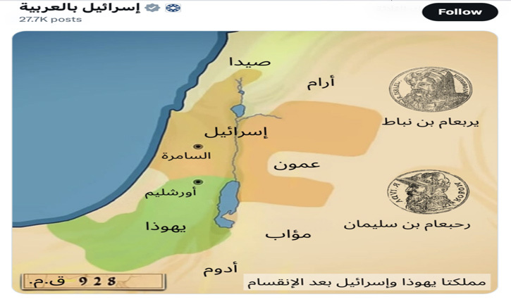
Israel publishes new map
News Desk || risingbd.com

Israel has published a map alleging the ancient Jewish kingdom’s territorial control over parts of modern-day Jordan, Syria, Lebanon and Egypt.
The map of the biblical land of Israel published by the official Israel Arabic account on X earlier this week has drawn condemnation from neighboring Jordan, which accused the Israeli government of encouraging continued “conflict and violence” in the region.
The map highlighted the boundaries of the historic kingdoms of Israel and Judah in 928 BC, which encompassed part of modern-day Jordan, Syria, and Lebanon, as well as areas controlled by the Palestinian Authority in the West Bank.
“Did you know that the Kingdom of Israel existed 3,000 years ago?” read the accompanying text, which offered a summary of the divide between Israel and Judah.
“This division led to political conflicts throughout the history of the people of Israel, and its effects continued for hundreds of years,” Israel Arabic wrote.
Palestine and Jordan on Tuesday strongly condemned an Israeli map showing Palestinian, Jordanian, Syrian, and Lebanese lands as part of Israel.
Palestinian Authority spokesman Nabil Abu Rudeineh called the Israeli map "a blatant violation of all international legitimacy resolutions and international law."
The Jordanian Foreign Ministry called the Israeli map “provocative and baseless” and “falsely claims historical territorial rights for Israel."
Source: Agencies
Dhaka/Mukul


